


06 Vol State Voting District, Sumner County, Tennessee
About
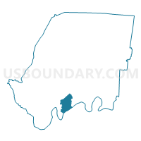
Outline

Summary
| Unique Area Identifier | 669811 |
| Name | 06 Vol State Voting District |
| County | Sumner County |
| State | Tennessee |
| Area (square miles) | 8.05 |
| Land Area (square miles) | 6.54 |
| Water Area (square miles) | 1.51 |
| % of Land Area | 81.28 |
| % of Water Area | 18.72 |
| Latitude of the Internal Point | 36.33520970 |
| Longtitude of the Internal Point | -86.49865510 |
Maps


Graphs
Select a template below for downloading or customizing gragh for 06 Vol State Voting District, Sumner County, Tennessee


Neighbors
Neighoring Voting District (by Name) Neighboring Voting District on the Map
- 04 Cooks UMC Church Voting District, Wilson County, TN
- 04 County Admin. Bldg. Voting District, Sumner County, TN
- 05 LaGuardo Utility District Voting District, Wilson County, TN
- 06 Gallatin Sr. High School Voting District, Sumner County, TN
- 06 Jack Anderson Voting District, Sumner County, TN
- 07 Saundersville Voting District, Sumner County, TN
Top 10 Neighboring County Subdivision (by Population) Neighboring County Subdivision on the Map
- District 7, Sumner County, TN (15,376)
- District 6, Sumner County, TN (14,535)
- District 4, Sumner County, TN (13,739)
- District 5, Wilson County, TN (6,291)
- District 4, Wilson County, TN (4,639)
Top 10 Neighboring Place (by Population) Neighboring Place on the Map
Top 10 Neighboring Unified School District (by Population) Neighboring Unified School District on the Map
Top 10 Neighboring State Legislative District Lower Chamber (by Population) Neighboring State Legislative District Lower Chamber on the Map
- State House District 57, TN (84,276)
- State House District 45, TN (72,256)
- State House District 44, TN (70,843)
Top 10 Neighboring State Legislative District Upper Chamber (by Population) Neighboring State Legislative District Upper Chamber on the Map
Top 10 Neighboring 111th Congressional District (by Population) Neighboring 111th Congressional District on the Map
Top 10 Neighboring Census Tract (by Population) Neighboring Census Tract on the Map
- Census Tract 302.04, Wilson County, TN (6,337)
- Census Tract 212.03, Sumner County, TN (4,862)
- Census Tract 205.01, Sumner County, TN (4,452)
- Census Tract 209.03, Sumner County, TN (3,499)